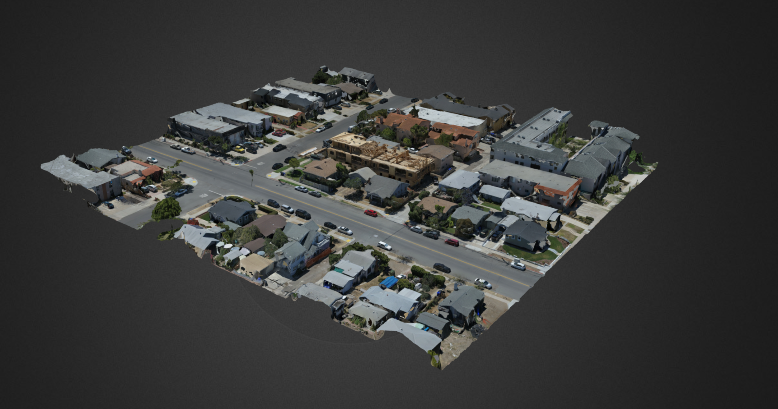
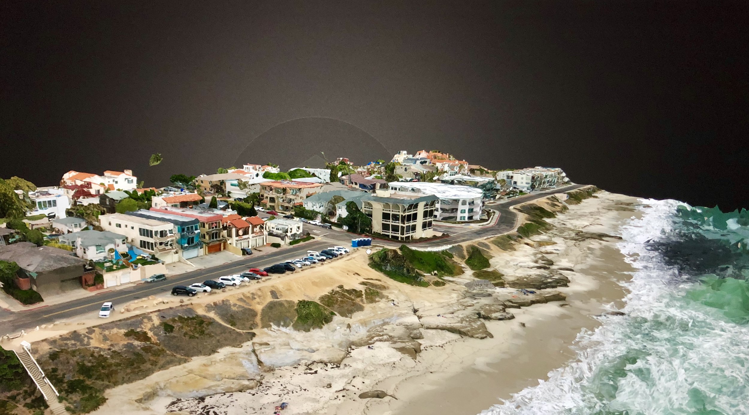
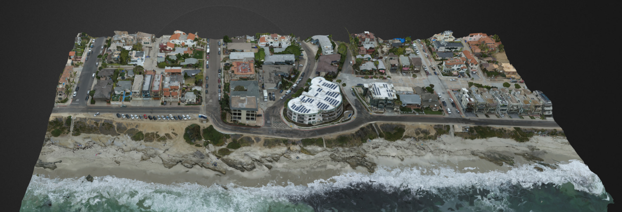
3d aerial imaging
aerial 3d mapping services available
we use orthomosaics and photogrammetry to create high fidelity 3D maps with our drones. The photos and data collected by the drone are then stictched together into an OBJ file for use in 3d rendering programs such as lumion.